

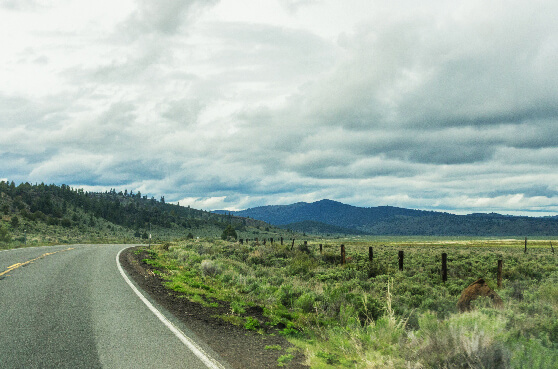
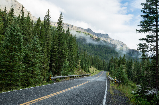
is the Dalton Highway in Alaska

I chose Alaska's Dalton Highway as my favorite, as it’s a road that reaches the top of the continent, and would literally allow you to see a polar bear in the right circumstances. All these roads offer so much. US 50 in Utah allows you to travel back through geological time, and Maine's Old Canadian byway is where human history unfolds around every bend. - James Q Martin
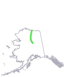
#1
Alaska
State Route 11
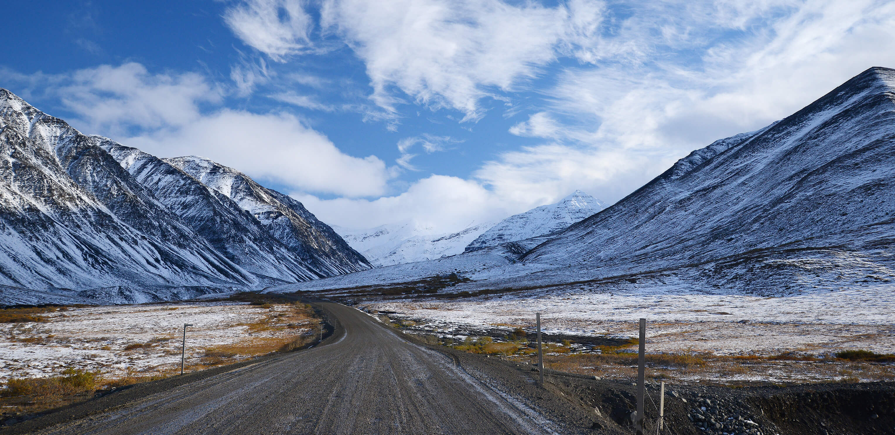
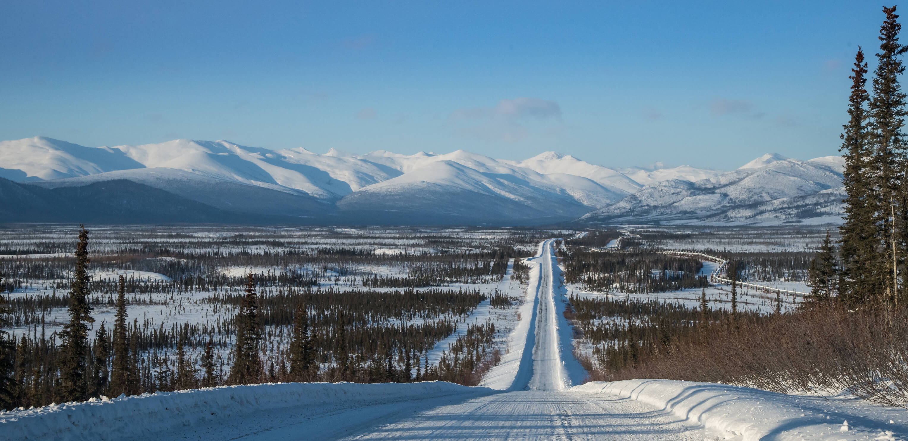
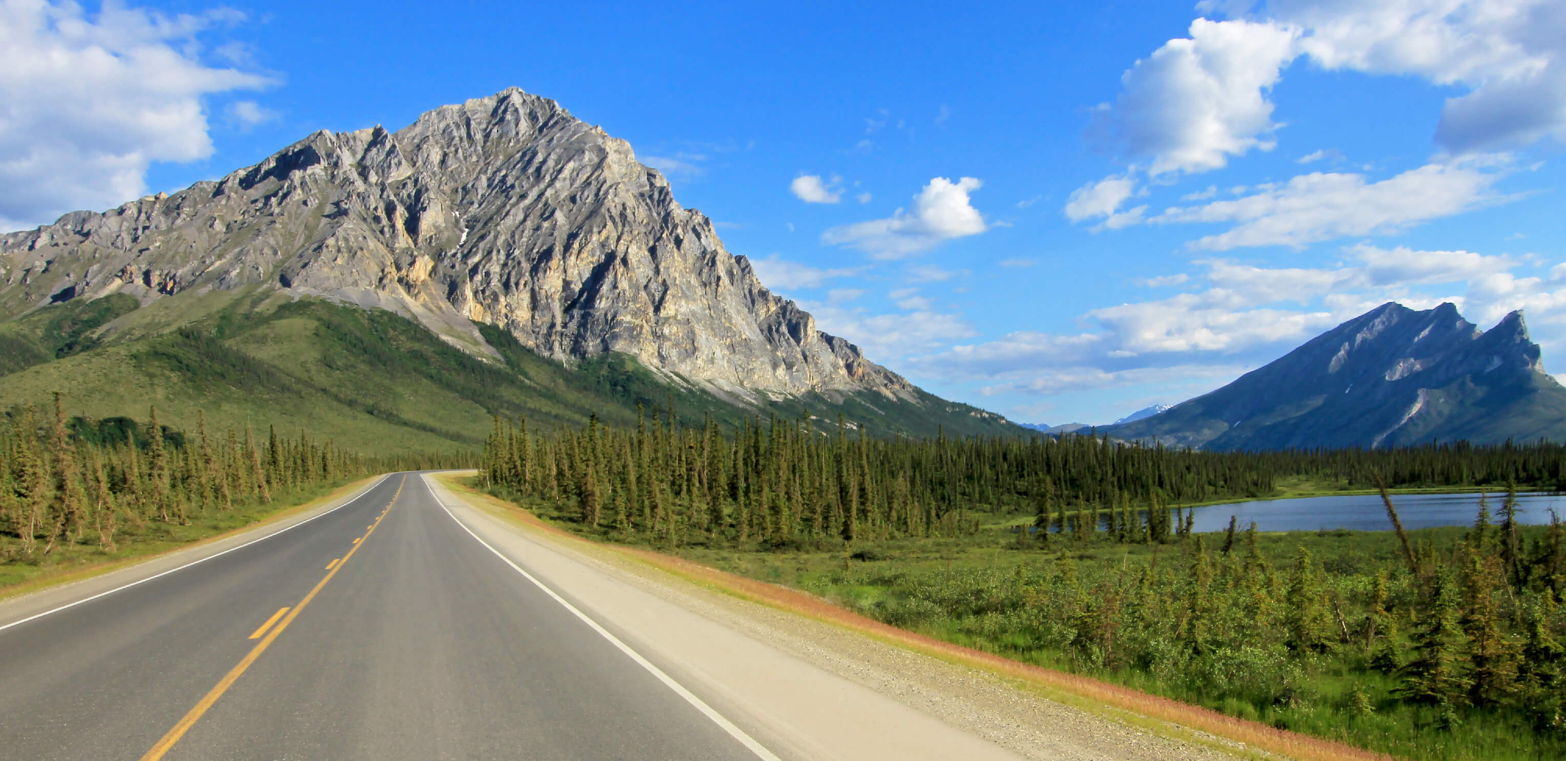
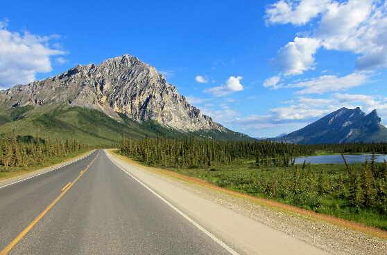
The Dalton Highway is one of America's harshest and most remote routes. We’re talking 240 miles between services and only a handful of small towns along the way. It’s mostly the "ice road truckers" who make the difficult journey along this gravel highway, travelling through Alaska’s boreal forests, across its vast mountain ranges, over the Yukon River, all the way to the Arctic Ocean.
What to see Arctic Ocean (tour only)
Yukon River
Northern Lights (August)
Route length 414 miles
Start to end Fairbanks -> Deadhorse
#2
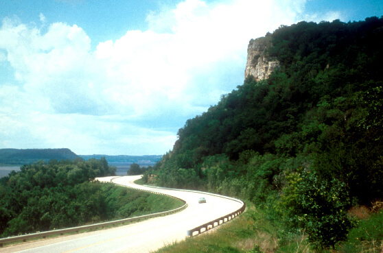
Utah
US Route 50
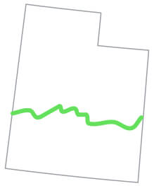
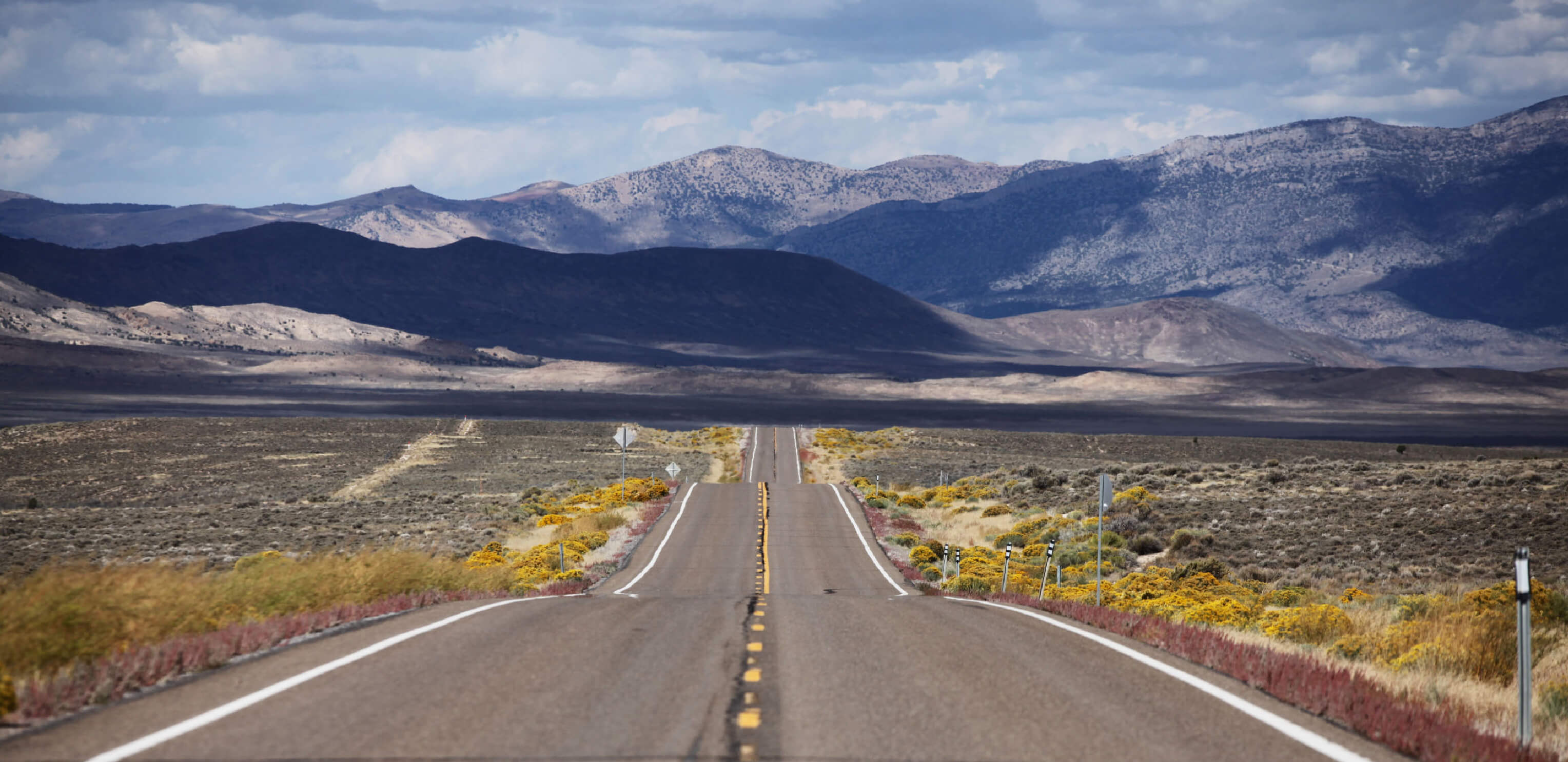
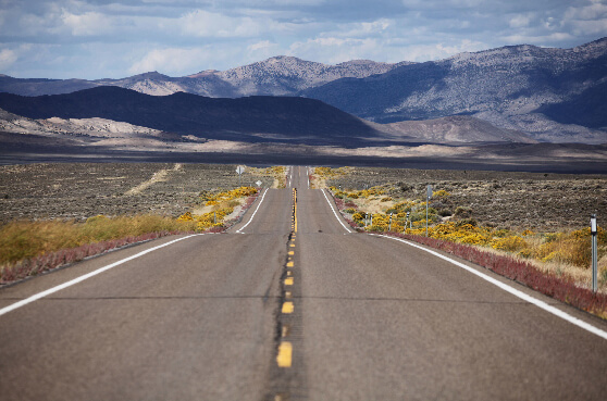
This entire 3,000 mile route is dubbed “America’s Loneliest Road.” Route 50’s path cuts across the corner of Utah, passing by the Canyonlands National Park, the Arches National Park and through the vast emptiness of the Great Salt Lake Desert.
What to see Island in the Sky
The Needles (Canyonlands)
The Windows (Arches National Park)
Route length 335 miles
Start to end Nevada state line (east of Baker) -> Colorado state line (west of Fruita)
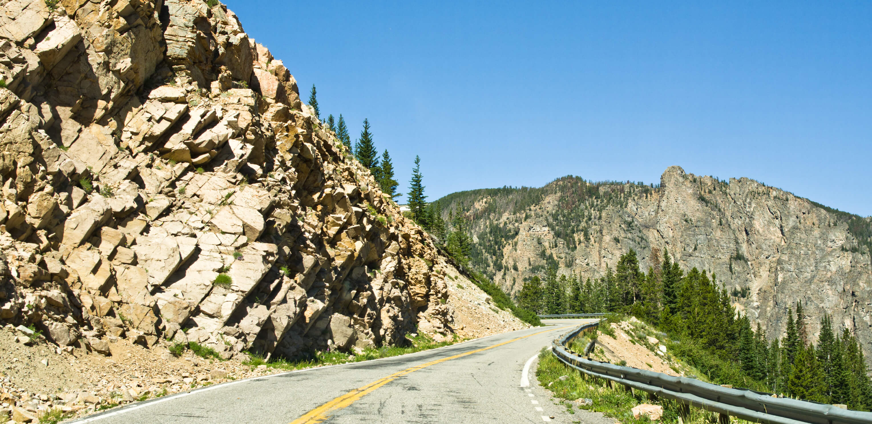
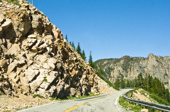
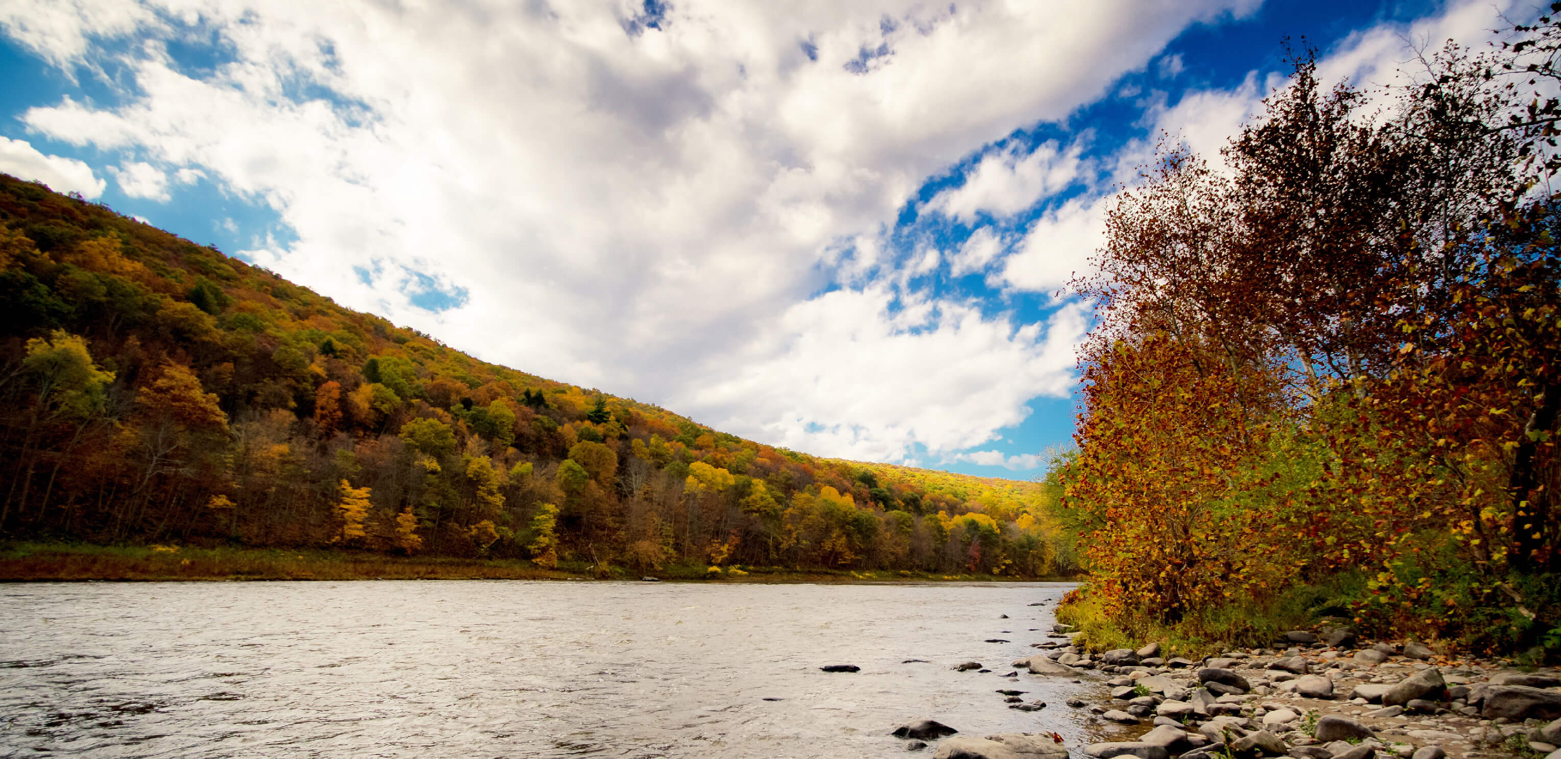
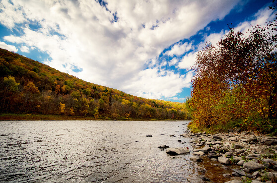
#3
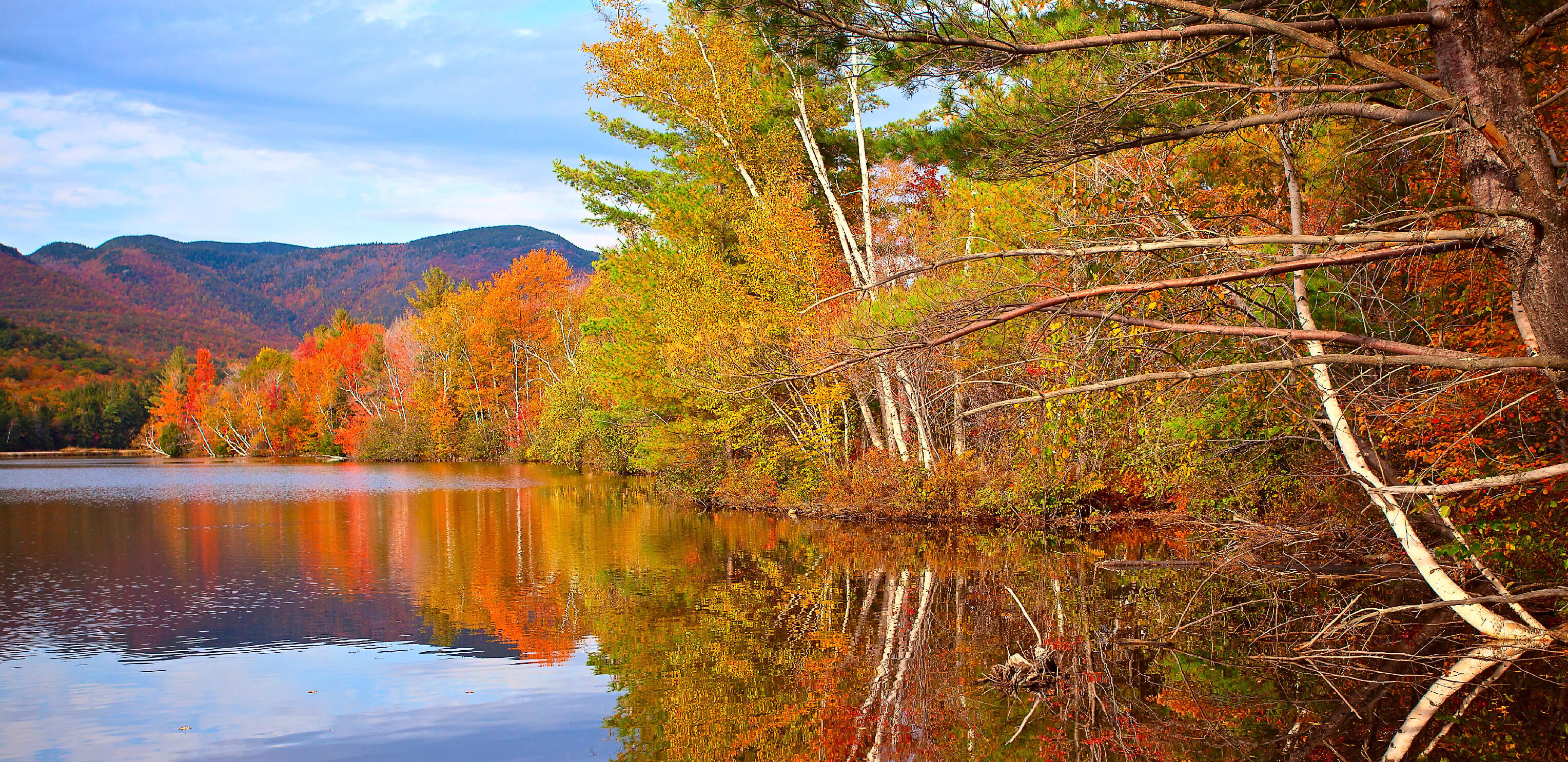
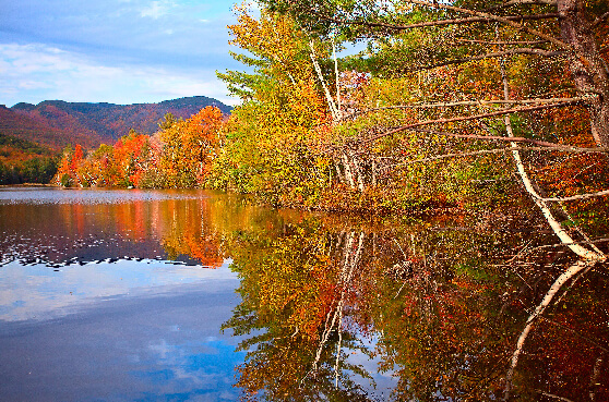
Maine
US Route 201
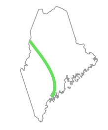
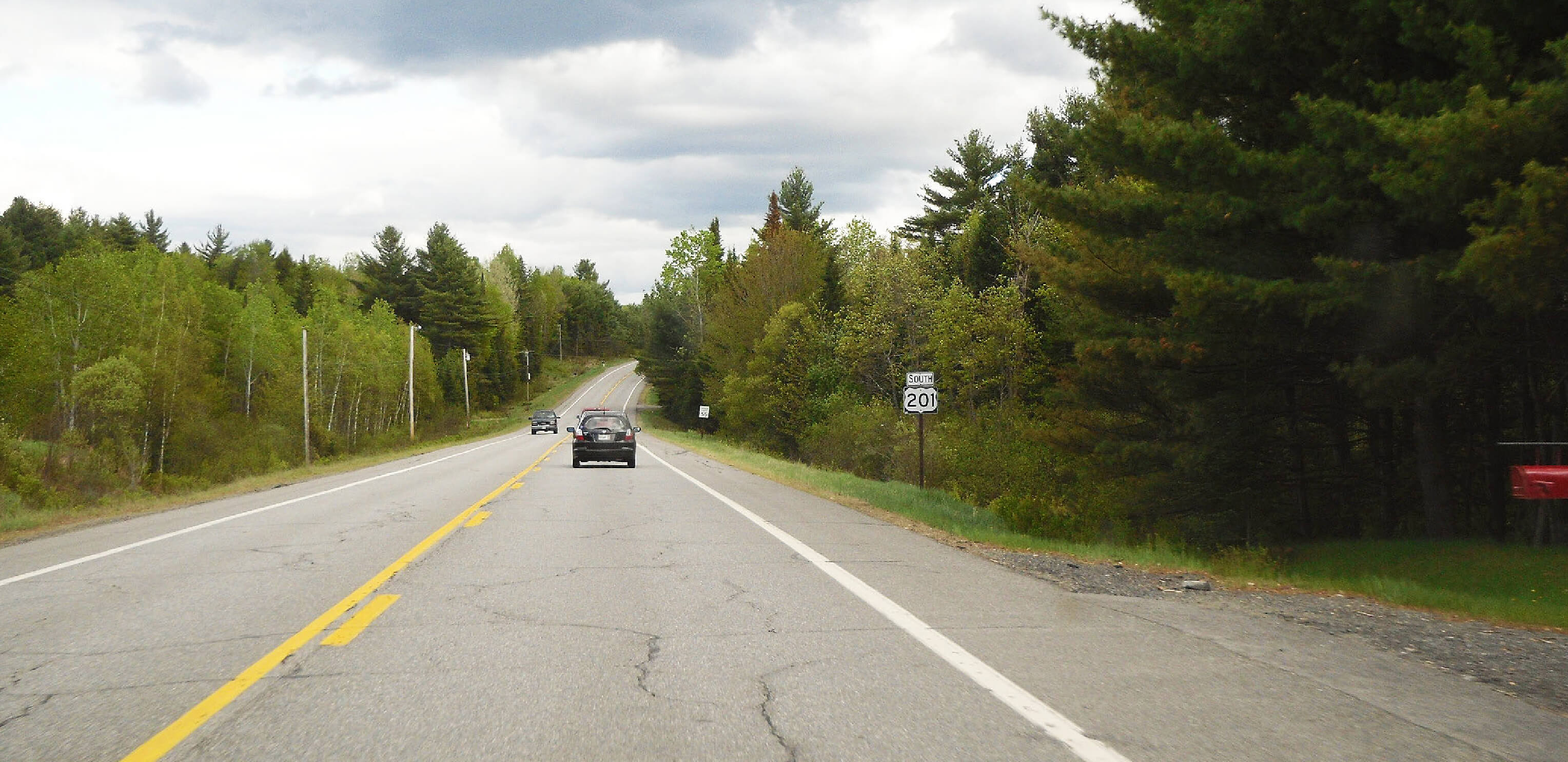
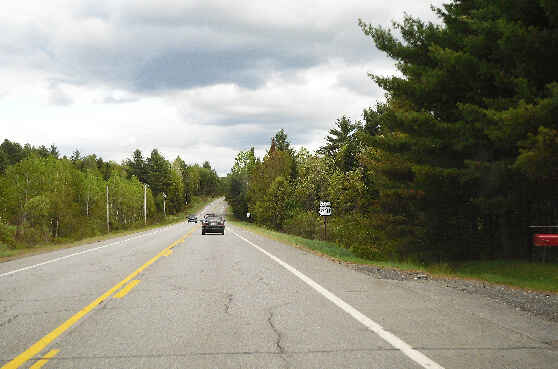

"Old Canada Road" is a rural, tree-lined route following the Kennebec River through historic towns like Bingham, passing Wyman Lake all the way up to the Quebec border. It’s at its colorful best during the fall.
What to see Bingham
Fall leaves
The Forks
Route length 157 miles
Start to end Brunswick, Cumberland County -> Sandy Bay (Canadian border)
#4
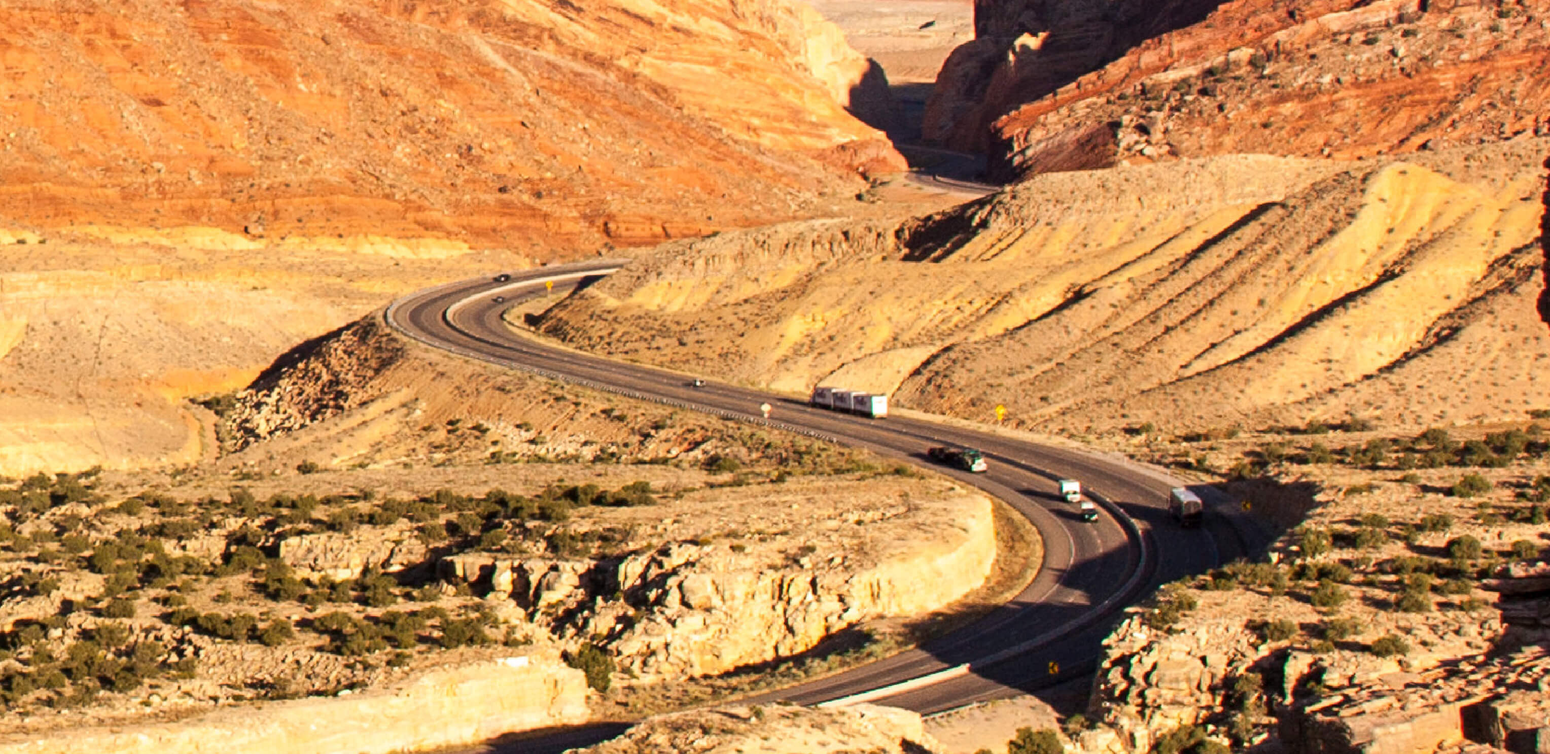
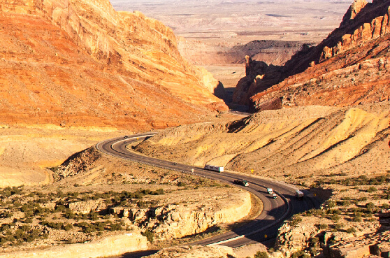
Arizona
US Route 160
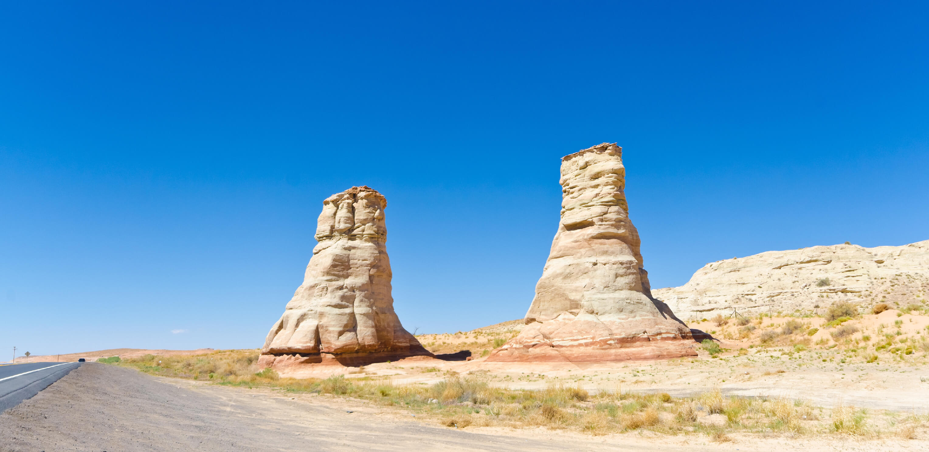
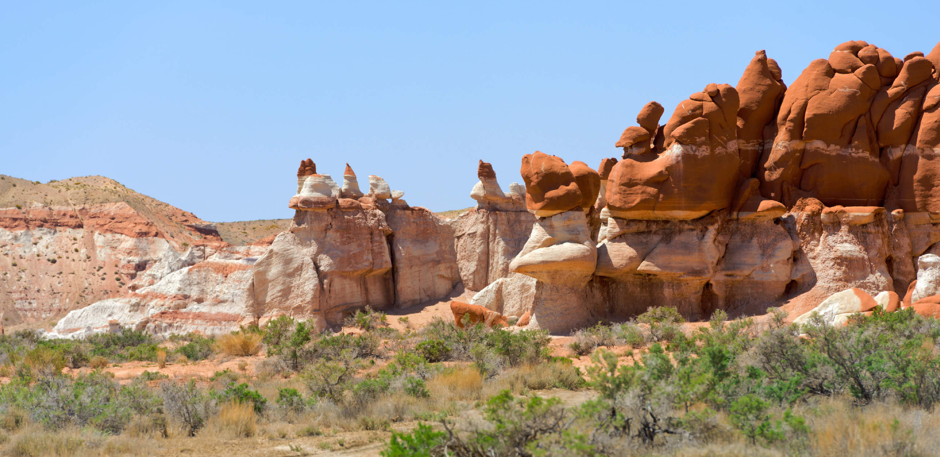
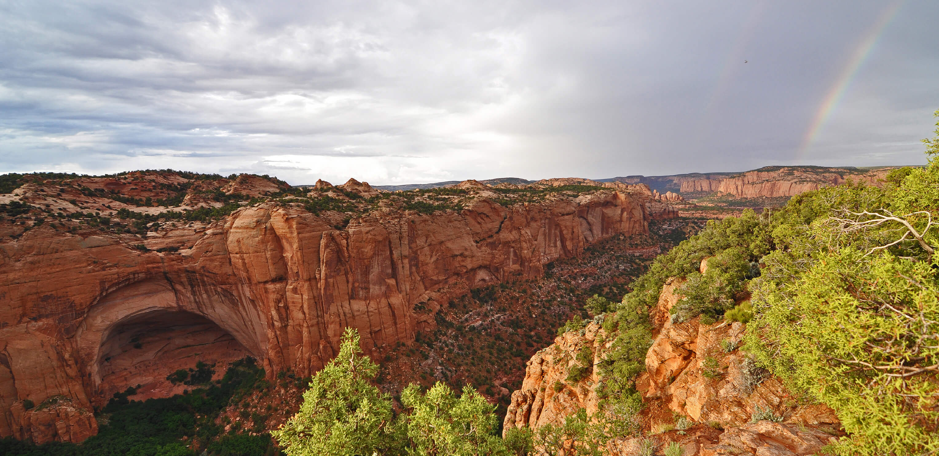
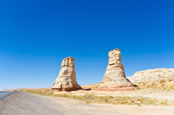
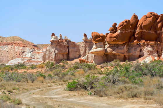
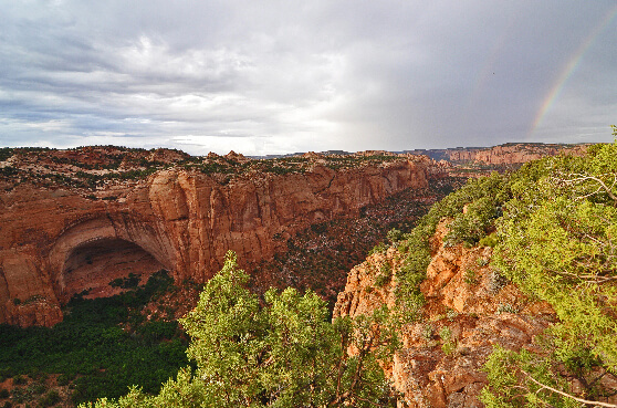
This isolated route runs through the deserted Navajo Nation. These "empty" stretches of highway are surrounded by sandy brush land, wind-worn sandstone canyons, an ancient Pueblo cliff village and unusual rock formations like the Elephant’s Feet, making this an incredibly scenic drive.
What to see Dinosaur tracks at Tuba City
Navajo National Monument
Elephant’s Feet rock
Route length 256 miles
Start to end Tuba City -> Teec Nos Pos, Apache County (New Mexico state line)
#5
California
State Route 139
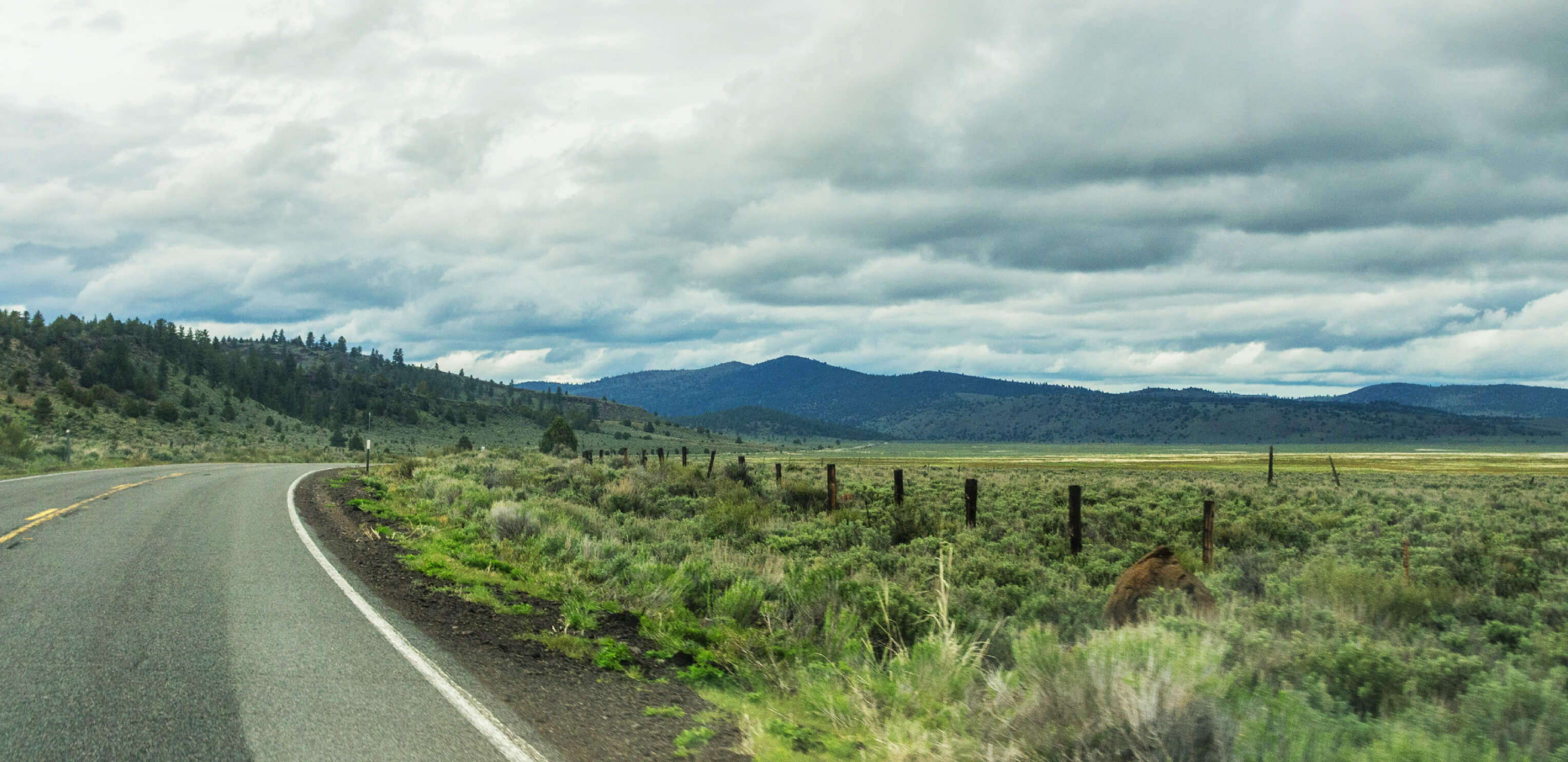
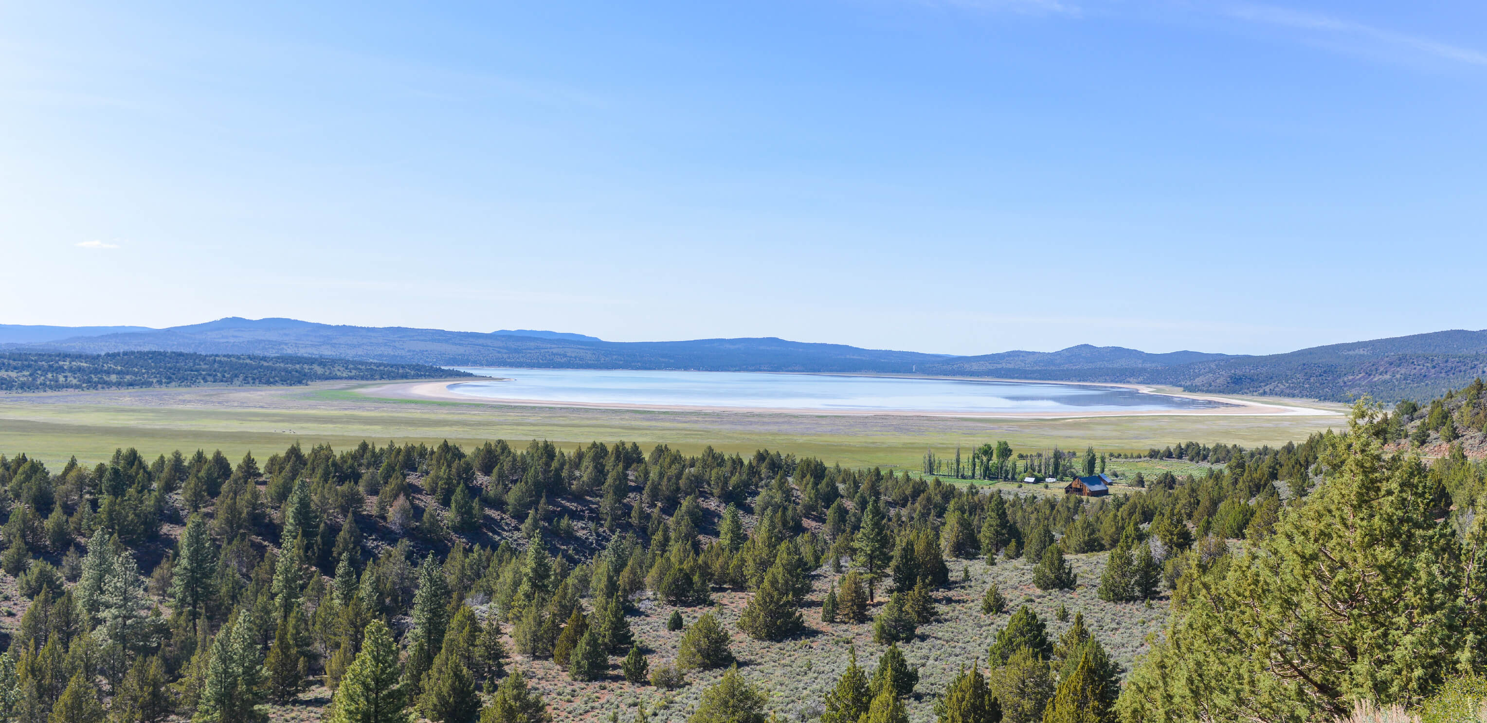
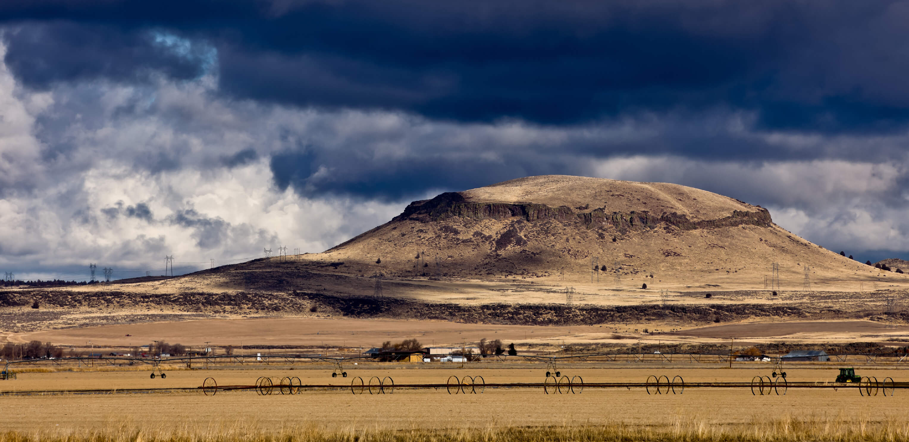
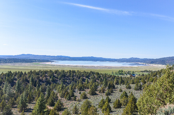
This remote route skirts around the beautiful blue Eagle Lake, before cutting through the Modoc National Forest. It’s a great starting point for hikes around the rugged volcanic landscape of north eastern California.
What to see Eagle Lake
Modoc National Forest
Lava Beds National Monument
Route length 143 miles
Start to end Susanville -> Oregon state line
#6
Virginia
State Route 90003
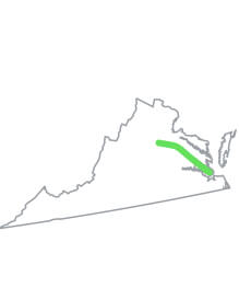
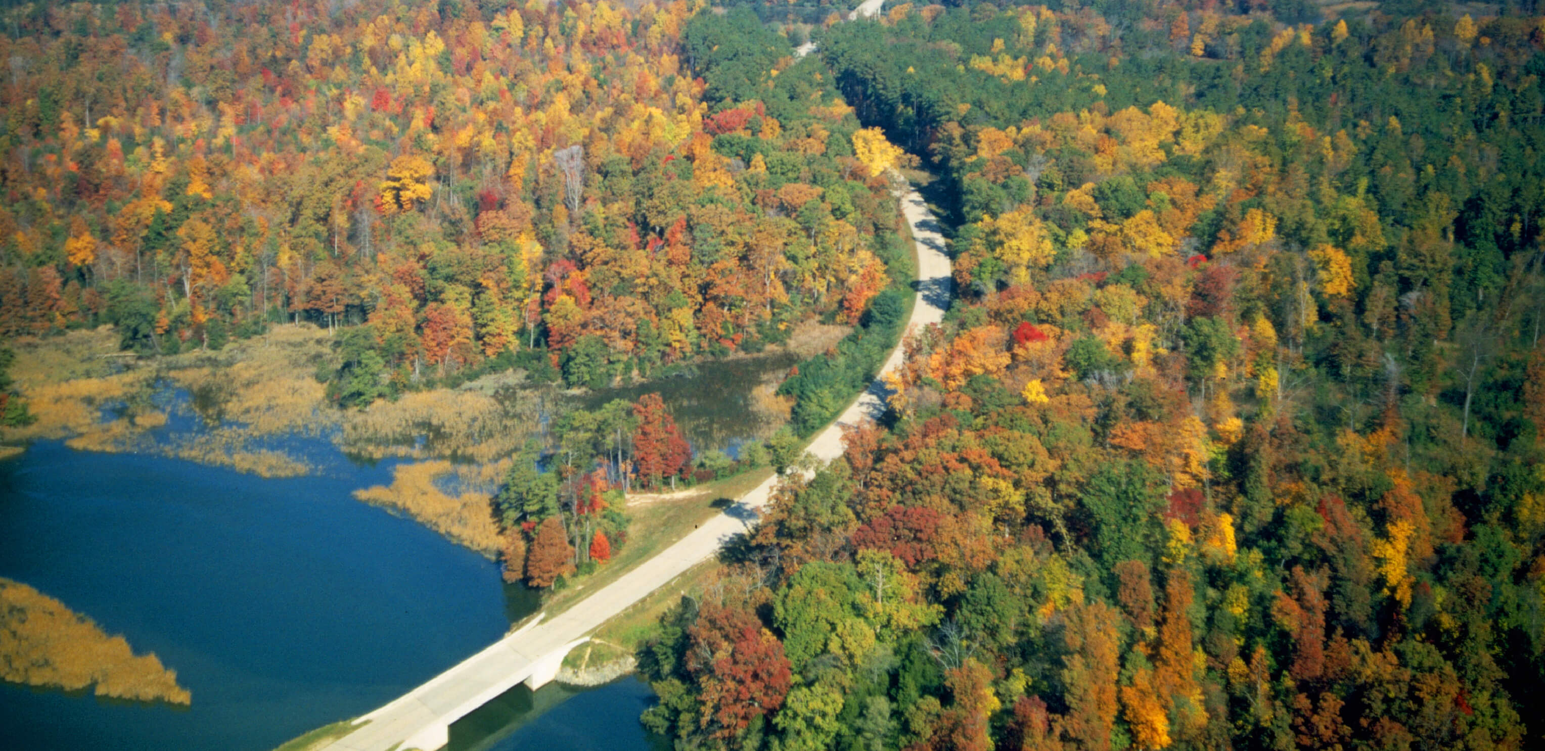
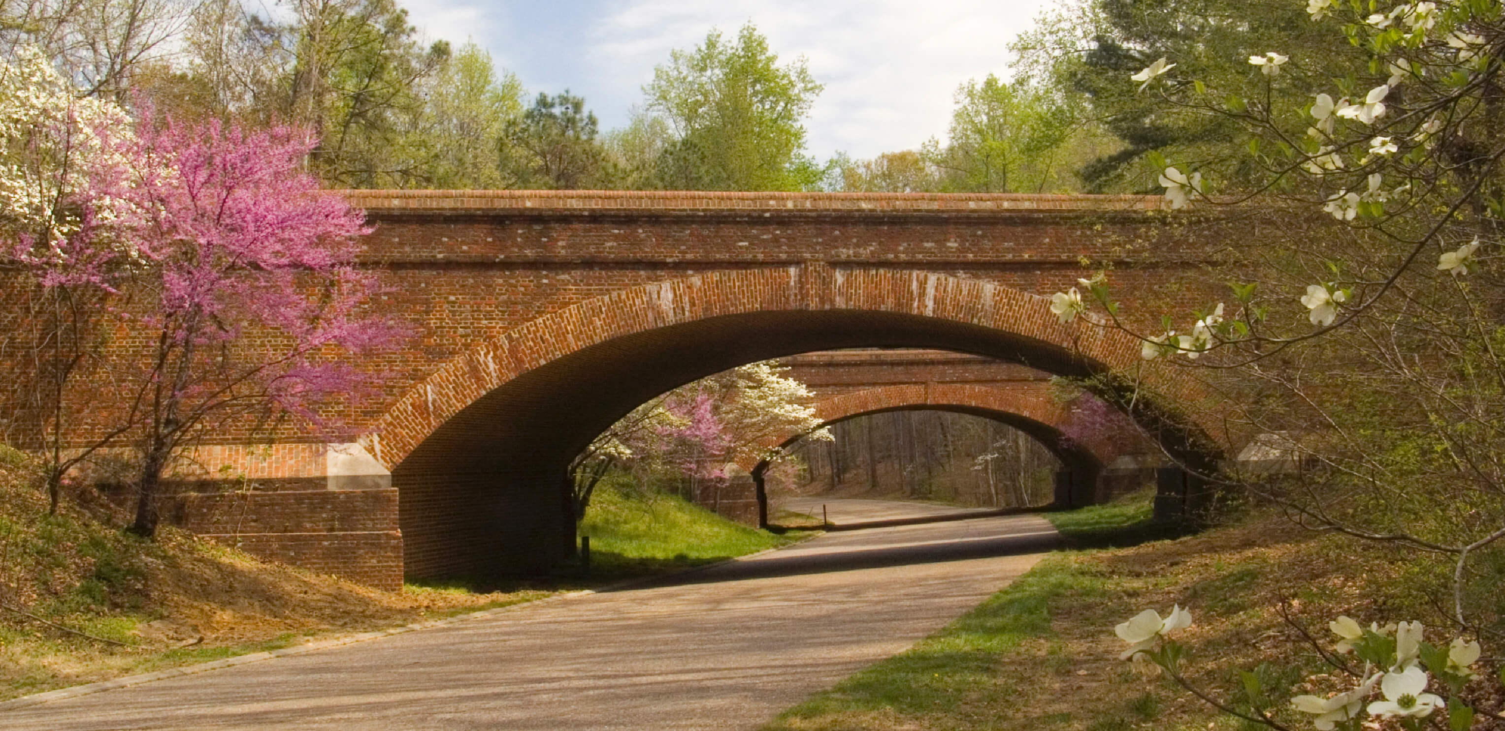
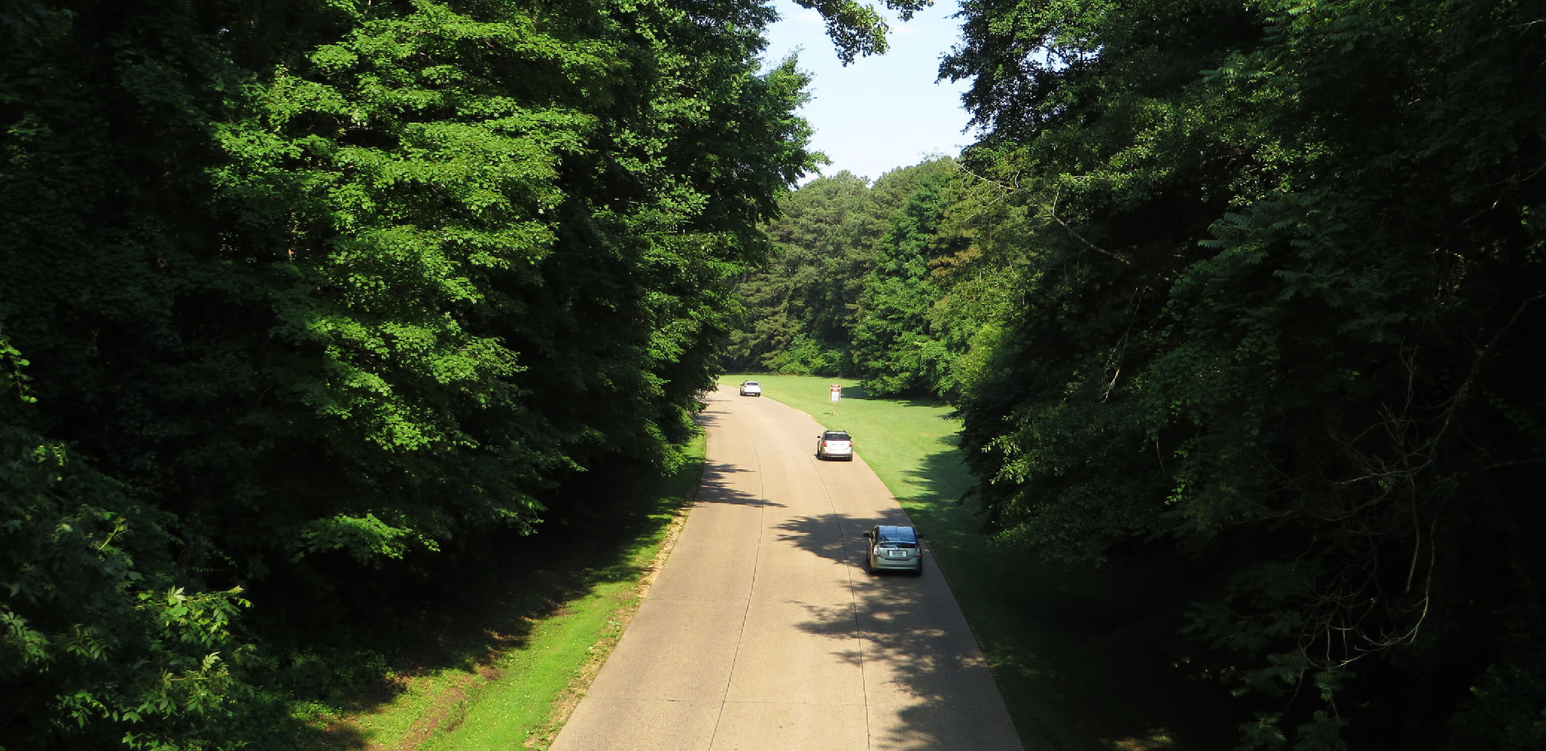
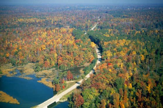
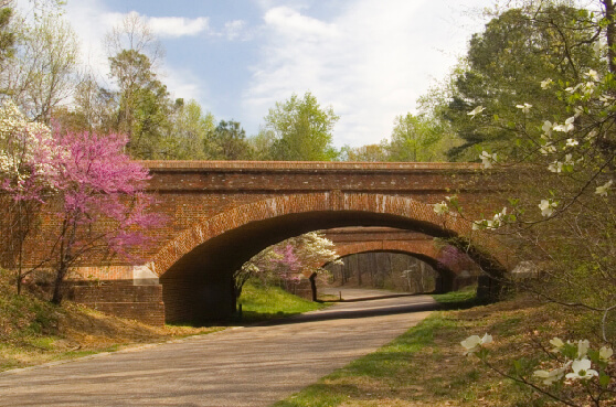
Better known as the Colonial Parkway, this nationally historic, scenic byway is bordered by trees and dotted with colonial-style red brick bridges and tunnels. Make a stop at the James River and York River at each end for the panoramic views, especially in the fall.
What to see Jamestown
Colonial Williamsburg
Yorktown
Route length 23 miles
Start to end Yorktown -> Jamestown
#7
Louisiana
US Route 65
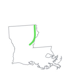
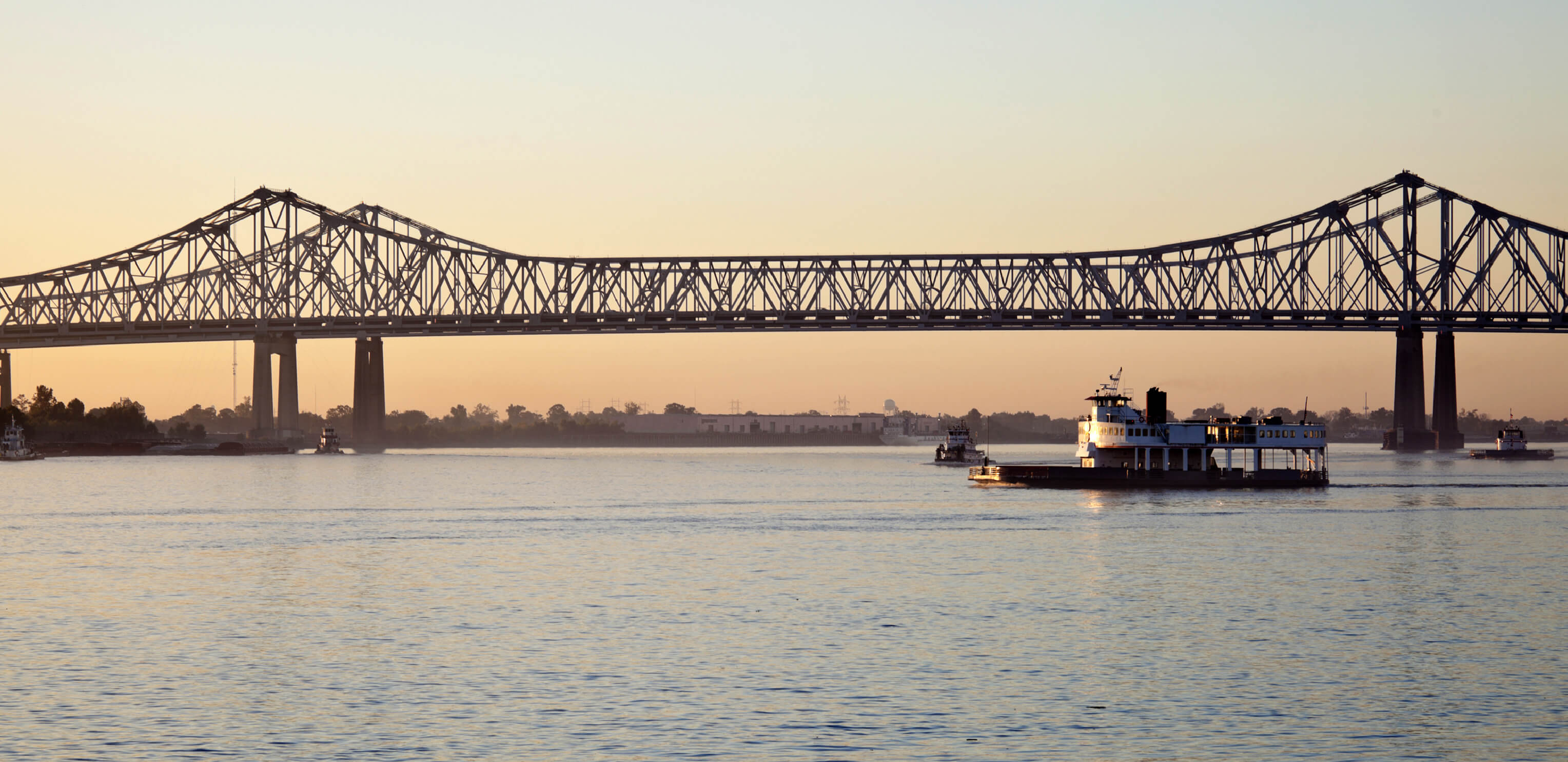
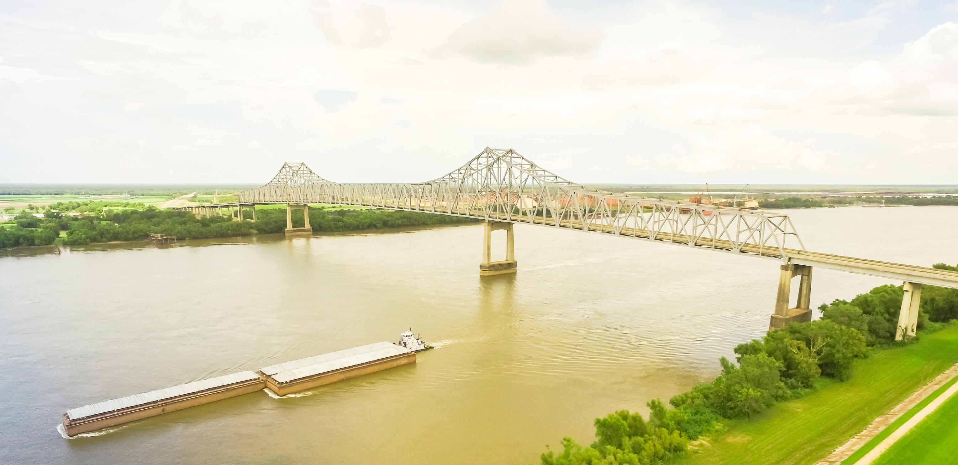
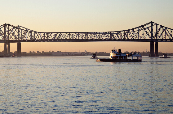

This stretch of highway is part of the Great River Road. The Louisiana section of this scenic, state-crossing drive, tracks alongside the Mississippi River, into Arkansas and beyond; passing the strikingly clear waters of Lake Bruin along the way.
What to see Tugboats on the Mississippi River
Lake Bruin
Tensas National Wildlife Refuge
Route length 101 miles
Start to end Clayton, Concordia Parish -> Arkansas state line north of Gassoway
#8
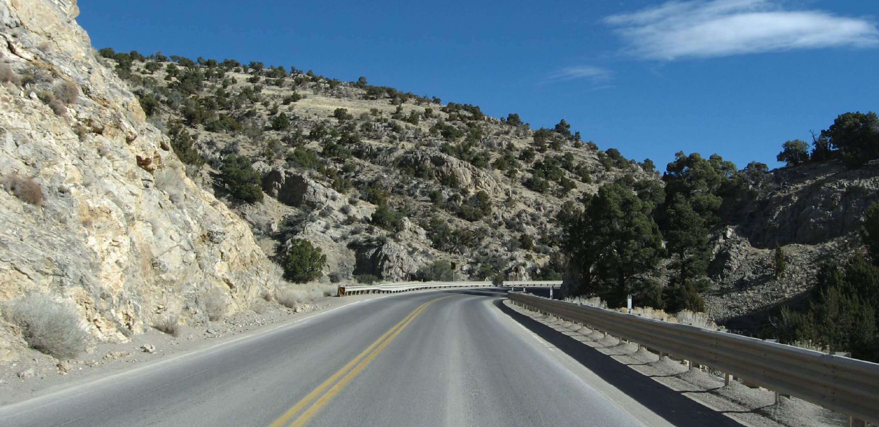
Wyoming
US Route 212

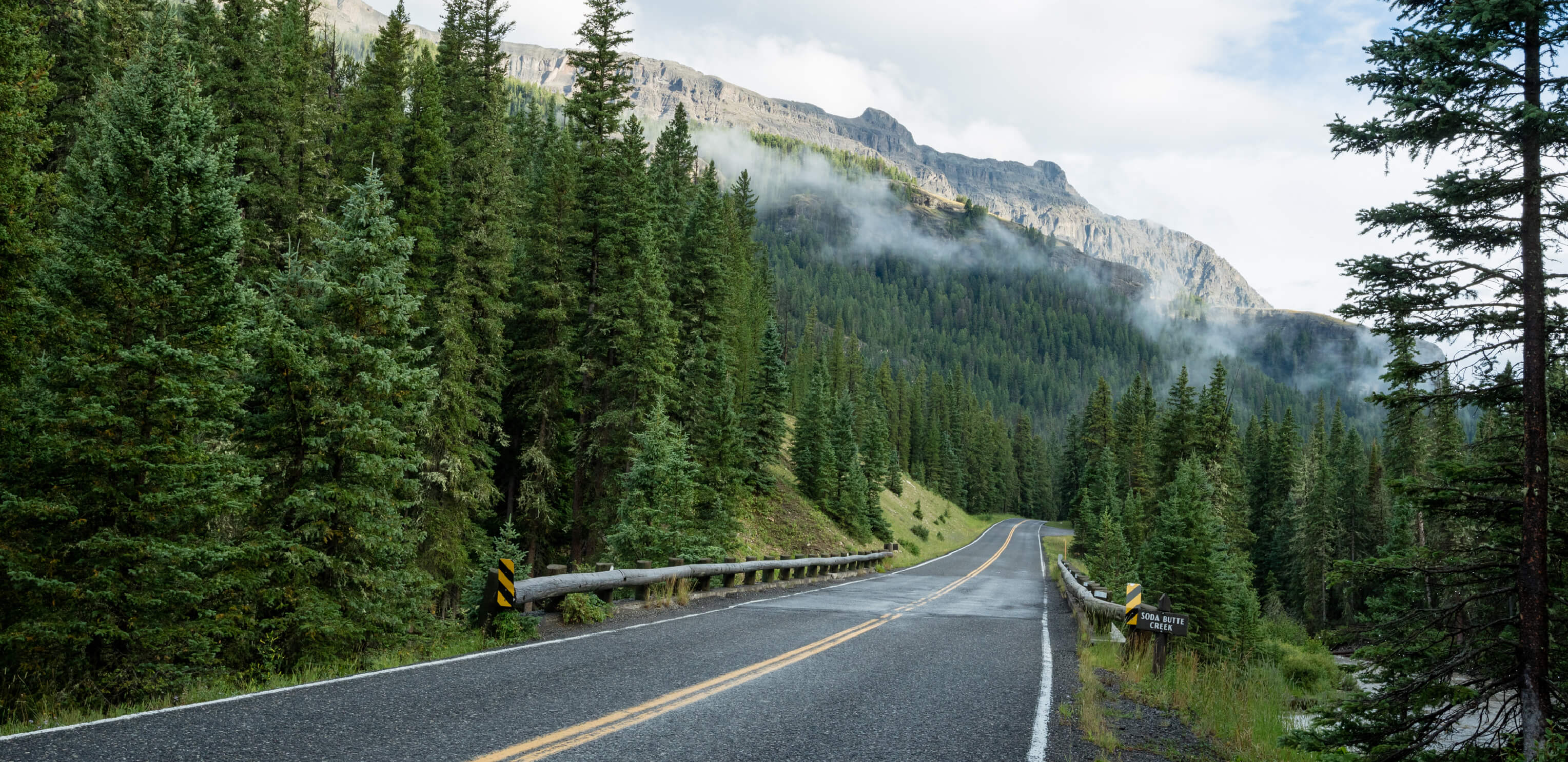
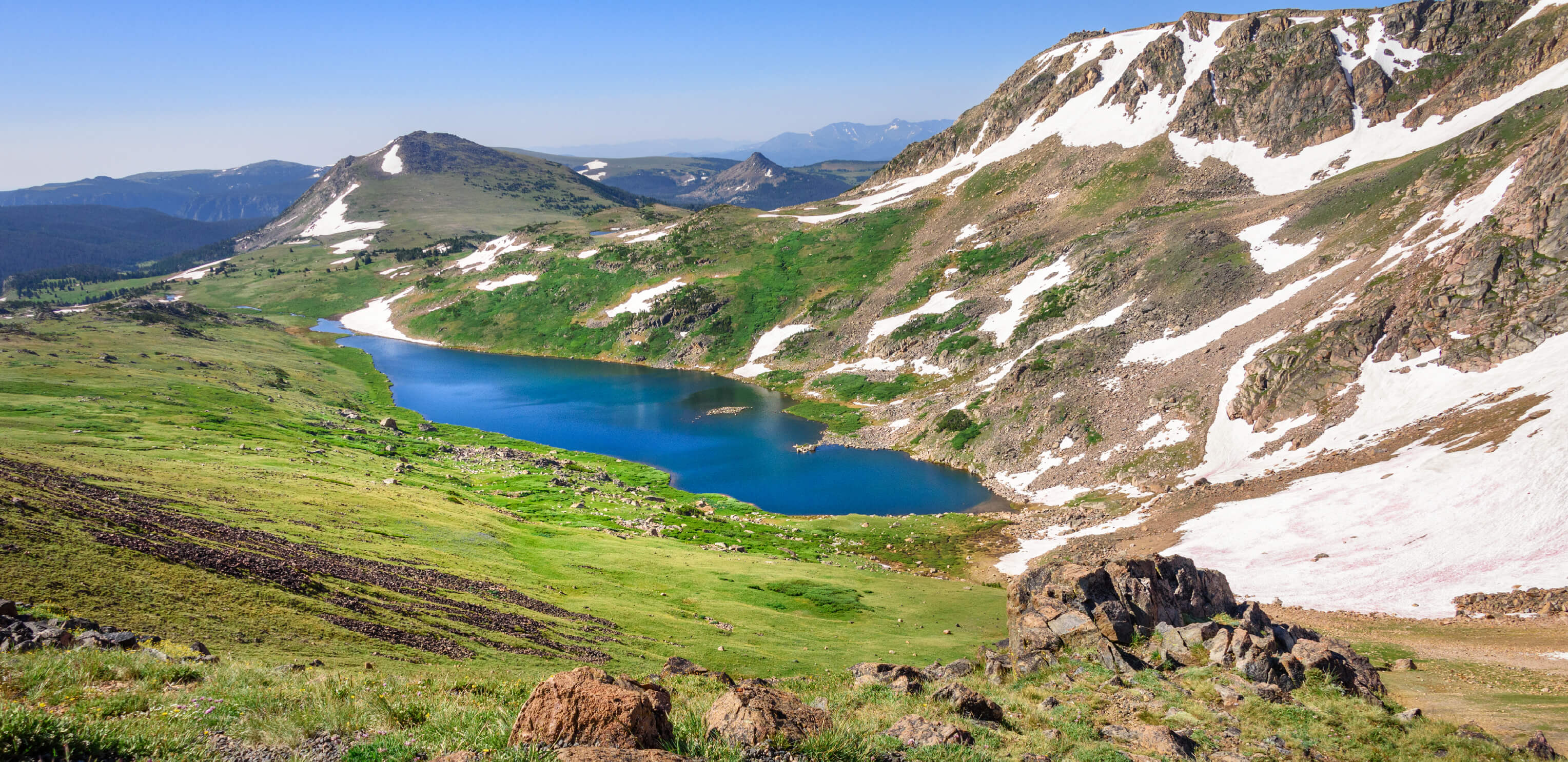
The Beartooth Highway is Wyoming's highest route. It leads into Yellowstone National Park, and has incredible views of jagged mountains, pine forests, rocky peaks and alpine lakes. During the winter, the road is closed due to heavy snow, but usually opens back up by Memorial Day weekend.
What to see Beartooth lake
Absaroka Mountains
Fossil forests
Route length 35 miles
Start to end Montana/Wyoming state line
#9
New Hampshire
US Route 2
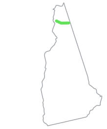
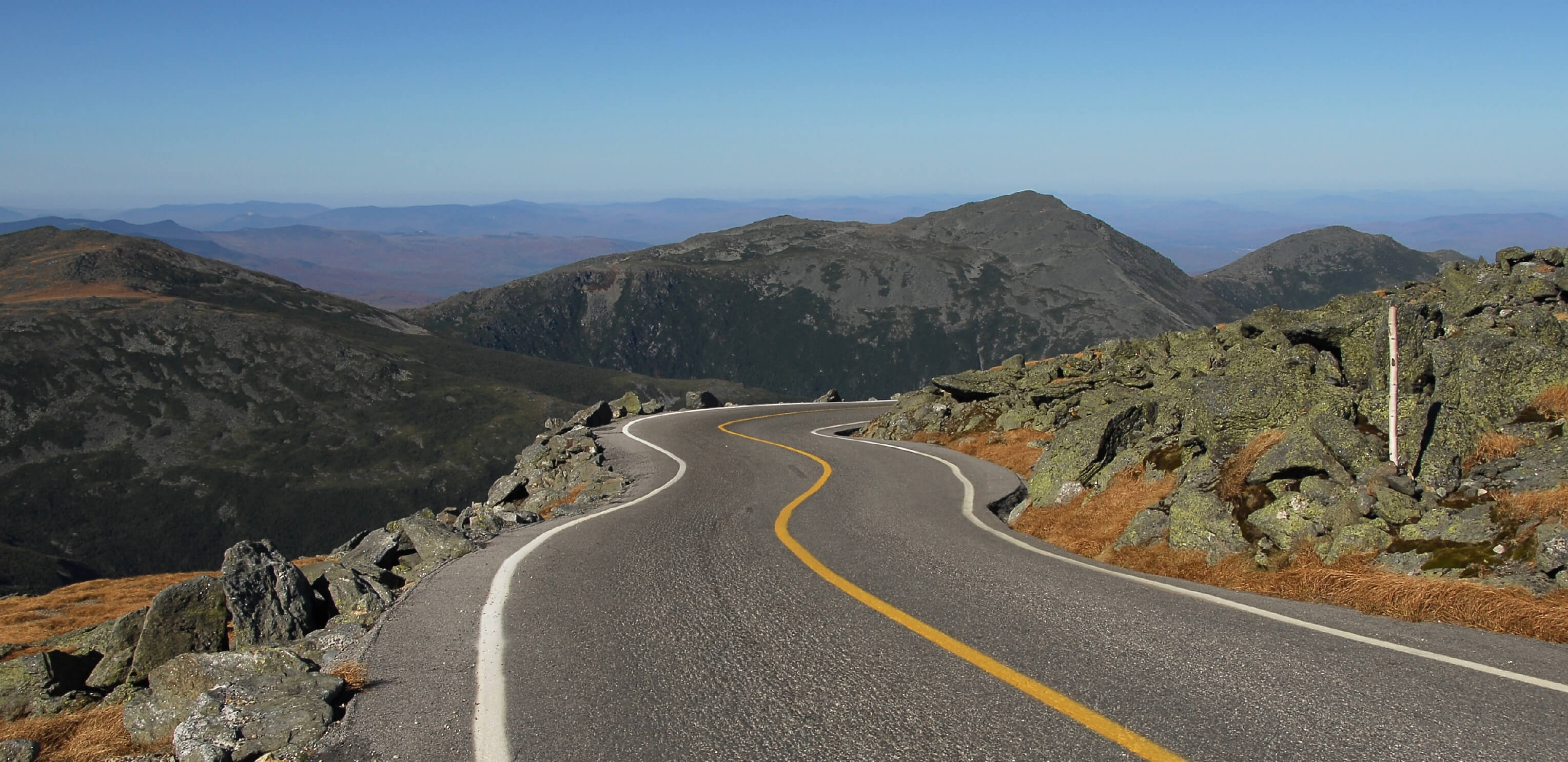
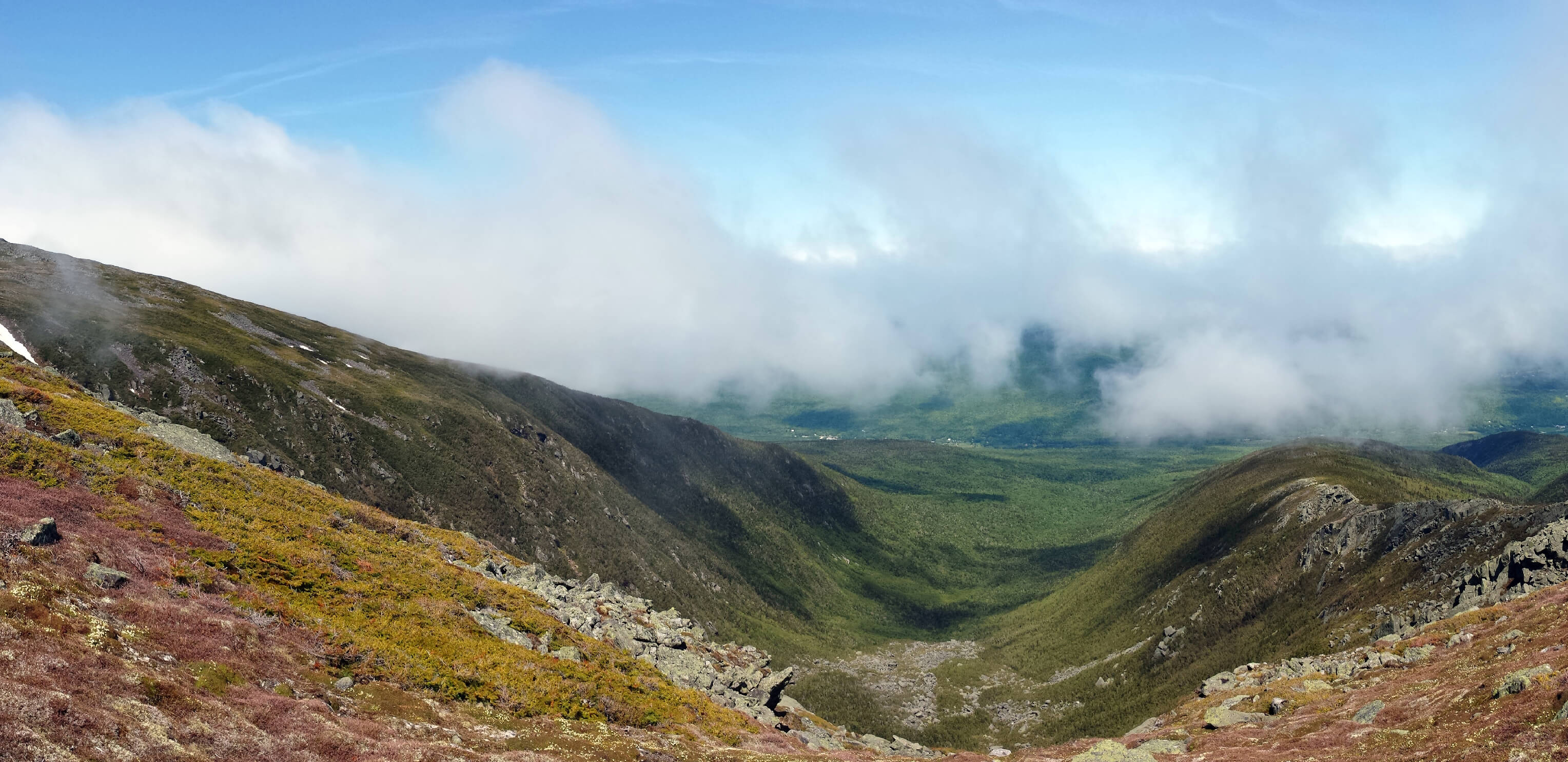
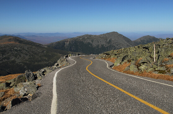
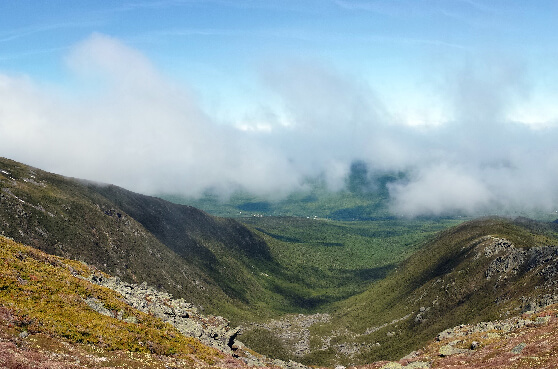
The long version of this scenic drive passes through several states. Here it winds alongside the Androscoggin River into the picturesque mountain ranges of New Hampshire. A detour takes you into the White Mountains National Forest and passes by the prominent Mount Washington.
What to see Mount Washington
White Mountains National Forest
Route length 35 miles
Start to end Maine state border -> Coos County (Vermont state border)
#10
Pennsylvania
State Route 32
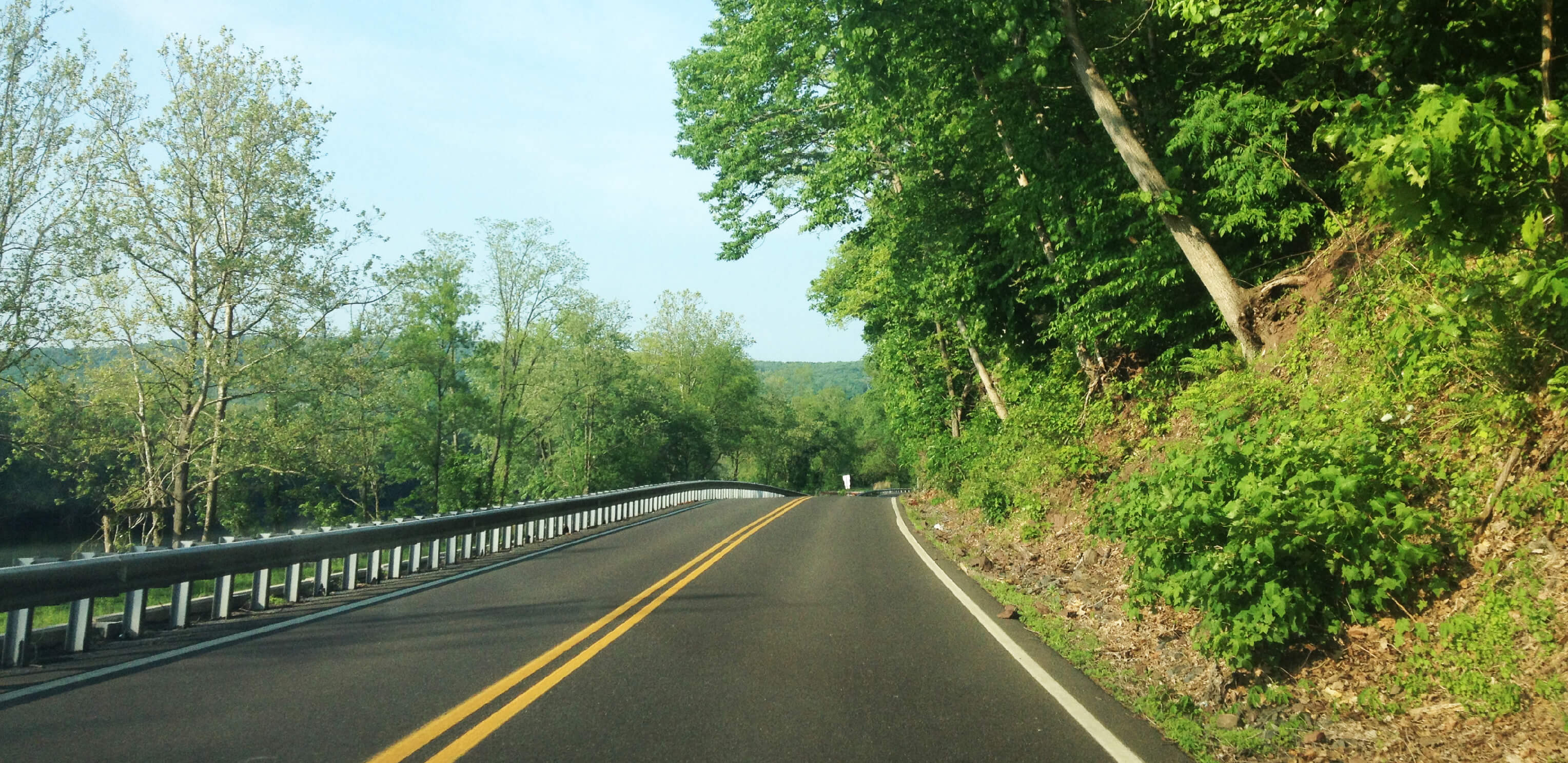
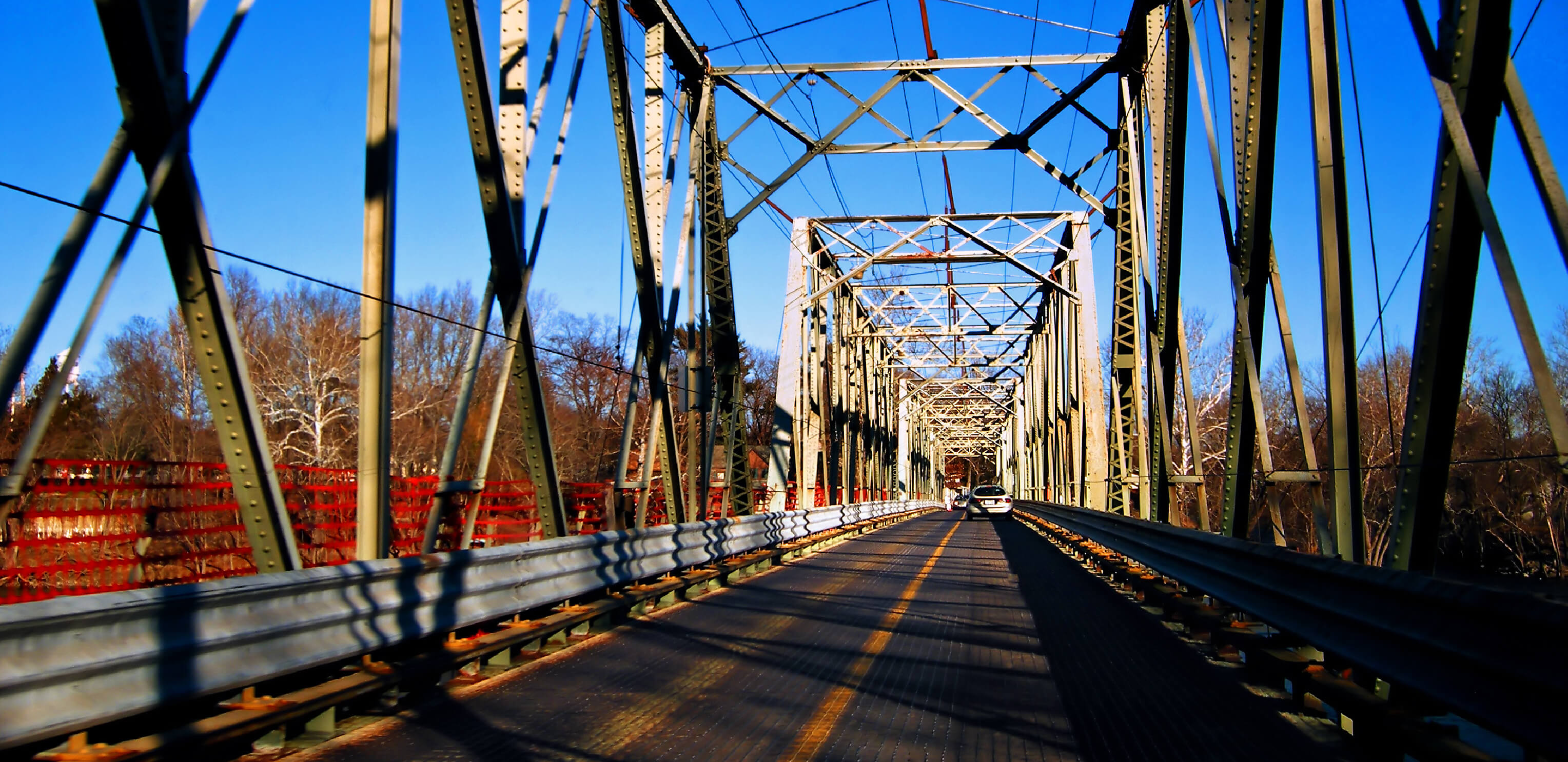
Known as the River Road, this scenic drive follows the Delaware River as it runs alongside the New Jersey border. Historic stops along the way include the Washington River Crossing and the arts and crafts town of New Hope.
What to see New Hope
Washington River Crossing
Yardley Railroad bridge
Route length 41 miles
Start to end Falls Township -> Kintnersville, Nockamixon
Alabama
State Route 5
Route length 198 miles
Start to end Thomasville, Clarke County -> Natural Bridge, Winston County
Alaska
State Route 11
Route length 414 miles
Start to end Fairbanks -> Deadhorse
Arizona
US Route 160
Route length 256 miles
Start to end Tuba City -> Teec Nos Pos, Apache County (New Mexico state line)
Arkansas
US Route 165
Route length 183 miles
Start to end Ashley County, Arkansas -> North Little Rock, Pulaski
California
State Route 139
Route length 143 miles
Start to end Susanville -> Oregon state line
Colorado
US Route 385
Route length 318 miles
Start to end Baca County (Oklahoma state line) -> Sedgwick County (Nebraska state line)
Connecticut
State Route 83
Route length 36 miles
Start to end Glastonbury, Hartford County -> Springfield (Massachusetts state line)
Delaware
State Route 18
Route length 19 miles
Start to end Federalsburg (Maryland state line) -> George Town, Sussex County
Florida
State Route 29
Route length 76 miles
Start to end Carnestown, Collier County -> Palmdale, Glades County
Georgia
State Route 24
Route length 222 miles
Start to end Statesboro -> Watkinsville
Hawaii
State Route 19
Route length 100 miles
Start to end Hilo -> Kailua-Kona
Idaho
US Route 89
Route length 44 miles
Start to end Bear Lake -> Geneva (Wyoming state line)
Illinois
State Route 96
Route length 141 miles
Start to end Kampsville -> Lomas
Indiana
State Route 145
Route length 45 miles
Start to end Tell City -> French Lick, Orange County
Iowa
State Route 4
Route length 146 miles
Start to end Panora -> North of Estherville (Minnesota state line)
Kansas
State Route 383
Route length 74 miles
Start to end Selden -> Woodruff (Nebraska state line)
Kentucky
State Route 10
Route length 118 miles
Start to end Alexandria, Campbell County -> Greenup, Scioto County
Louisiana
US Route 65
Route length 101 miles
Start to end Clayton, Concordia Parish -> Arkansas state line north of Gassoway
Maine
US Route 201
Route length 157 miles
Start to end Brunswick, Cumberland County -> Sandy Bay (Canadian border)
Maryland
US Route 219
Route length 48 miles
Start to end Red House (West Virginia state line) to Grantsville (Pennsylvania state line)
Massachusetts
State Route 32
Route length 61 miles
Start to end Monson (Connecticut state line) -> Royalston (New Hampshire state line)
Michigan
US Route 45
Route length 55 miles
Start to end Watersmeet -> Lake Superior
Minnesota
State Route 32
Route length 145 miles
Start to end Tansem Township, Clay County -> Greenbush, Roseau County
Mississippi
State Route 57
Route length 91 miles
Start to end McLain -> Gautier
Missouri
US Route 136
Route length 240 miles
Start to end Alexandria, Missouri -> Brownville (Nebraska state line)
Montana
State Route 19
Route length 21 miles
Start to end Grass Range -> Roy
Nebraska
State Route 71
Route length 170 miles
Start to end Kimball County (Kansas state line) -> Crawford, Dawes County (South Dakota state line)
Nevada
State Route 360
Route length 23 miles
Start to end Dyer -> Mina
New Hampshire
US Route 2
Route length 35 miles
Start to end Maine state border -> Coos County (Vermont state border)
New Jersey
State Route 49
Route length 54 miles
Start to end Pennsville Township, Salem County -> Upper Township, Cape May County
New Mexico
US Route 56
Route length 94 miles
Start to end Springer -> Clayton (Oklahoma state line)
New York
State Route 812
Route length 81 miles
Start to end Lowville, Lewis County -> Ogdensburg, Canada / US border
North Carolina
State Route 172
Route length 39 miles
Start to end Folkstone -> Starling, Onslow County.
North Dakota
State Route 24
Route length 211 miles
Start to end Fort Yates -> Solen
Ohio
State Route 571
Route length 50 miles
Start to end Union City, Indiana state line -> Bethel Township, Clarke County
Oklahoma
US Route 287
Route length 41 miles
Start to end Texas state line -> Cimarron County (Colorado state line)
Oregon
US Route 395
Route length 385 miles
Start to end New Pine Creek -> Columbia River (Washington state line)
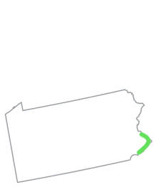
Pennsylvania
State Route 32
Route length 41 miles
Start to end Falls Township -> Kintnersville, Nockamixon
Rhode Island
State Route 102
Route length 44 miles
Start to end Wickford, Washington County -> Slatersville, Providence County
South Carolina
US Route 321
Route length 217 miles
Start to end Hardeeville -> Bowling Green (North Carolina state line)
South Dakota
State Route 73
Route length 255 miles
Start to end Lemmon (North Dakota state line) -> Martin (Nebraska state line)
Tennessee
State Route 104
Route length 114 miles
Start to end Milan -> Saltilo
Texas
State Route 49
Route length 61 miles
Start to end Mount Pleasant -> Louisiana state line (near Trees)
Utah
US Route 50
Route length 335 miles
Start to end Nevada state line (east of Baker) -> Colorado state line (west of Fruita)
Vermont
State Route 103
Route length 42 miles
Start to end Rockingham, Windham County -> Clarendon, Rutland County
Virginia
State Route 90003
Route length 23 miles
Start to end Yorktown -> Jamestown
Washington
State Route 127
Route length 27 miles
Start to end Garfield County -> Dusty
West Virginia
State Route 93
Route length 33 miles
Start to end Davis, Tucker County -> Mineral County
Wisconsin
State Route 80
Route length 163 miles
Start to end Hazel Green -> Marshfield
Wyoming
US Route 212
Route length 35 miles
Start to end Montana/Wyoming state line